The horrors of arsenic in Bangladesh is considered a red hot zone for arsenic and being exposed to groundwater arsenic has been a serious health issue for the last two decades in this country. So this paper aims to illuminate the analysis and comparison of different physical groundwater parameters of an arsenic affected area and non-affected area. In addition to that, it examines the role of these parameters towards the availability of arsenic in a certain area. Of those parameters TOC is considered with highest significance along with pH, alkalinity and electric conductivity.
So in short the study has mainly four goals which are statistical analysis, comparison of parameters, assessing relationship between them and color mapping of parameters of those areas. Prior studies indicate that organic carbon has been a very good influence on arsenic availability and this study extends this fact by comparing TOC range of an arsenic affected area and non-affected area. Different upazillas of Munshiganj district were selected as arsenic affected area and upazillas from Bogra district were selected as non-affected area according to the survey conducted by British Geological Survey in 2001. Groundwater samples were collected from those areas from irrigation wells over the period of February to June. After that pH, alkalinity, electric conductivity and TOC was tested in the laboratory subsequently. The findings from the data illustrate that the TOC of Munshiganj is much higher than Bogra. It also shows a good linear correlation of alkalinity and TOC with electric conductivity but rest of the parameters showed no relation among them.
An empirical equation is produced to estimate TOC combining rest of the parameters and finally spatial analysis was performed with sketched maps using GIS showing different concentrations of different parameters in the above mentioned regions. 2.0 Literature Review: The shallower groundwater aquifers in Bangladesh are getting more and more contaminated with different forms of exposure from the industrial and agricultural pollutants. These are creating different forms of problems and creating environmental hazards due to contamination from all the external sources as well as contamination from Arsenic. Groundwater quality is also important for irrigational purposes because poor water quality can cause toxicity, water infiltration, salinity etc.1 Munshiganj lies in the calcerous flood plain whereas Bogra carries normal soil which complies with the study of Ponnaperuma in 1977.2
In accordance with DPHE (Department of Public Health Engineering), the contamination due to Arsenic in Bangladesh is severe and about sixty-one districts are contaminated with arsenic.3 Considering all the population, about twenty-five to thirty percent are arsenic contaminated which are found in a large number of deep and shallow tube wells available. Arsenic causes different forms of diseases including Arsenicosis which is found in patients all over the country. Arsenic contaminated tube wells were found in different parts of the country in the year of 1995. The border belts of the country were found contaminated with arsenic in the year of 1996 by the GWHD (Ground Water Hydrology Division) in 1996. The concentration of arsenic in those parts of the country are considerably higher considering other coastal parts. According to Dhar et. al., there are substantial amount of skin diseases found in the patients with arsenic contamination including melanosis, keratosis along with skin cancer.4
There are different procedures to evaluate the groundwater contamination level with the help of finding the organic compounds. Determination of Total Organic Carbon (TOC) is a diagnostic approach to find out the extent of contamination in ground water aquifers.5 The existing methods of finding out the organic contamination level in groundwater is not suitable for the determination of contamination. This does not give the total amount of contamination due to the additional purging of inorganic carbon prior to analysis. Instead, this is more useful to monitor the total organic carbon (TOC) in ground water samples. This provides substantial results as infection by synthetic organic compounds may be specified when TOC concentrations are detected above background levels. In the studies of contaminant plume migration, these forms of surrogate parameters are mostly used. These help to make a rapid, inexpensive indication of the extent of organic contamination.
The horrors of arsenic in Bangladesh In normal situation there is the determination of Chemical Oxygen Demand (COD) or Biological Oxygen Demand (BOD), which are very laborious procedures in comparison with the measurement of TOC. Those methods are also not that much accurate like TOC determination as those values many get adulterated with the presence of reducing agents and different refractory compounds. The origin of dissolved arsenic in Munshiganj gave researchers a hard time from the report of widespread arsenic poisoning twenty years back. Different geotechnical transformations are liable for the release of arsenics from the sediments. Different forms of microbial compounds drive this transformation. These microbial compounds are thought to be meditated by oxygens. Still the process of the geotechnical transformations is unknown. Neumann et al. found groundwater-irrigated rice fields and constructed ponds used for groundwater recharge at a particular site in Bangladesh where they used a hydrologic and biogeochemical was analyzed to trace the origin of contaminated groundwater.6
It has been found that recharge from ponds contains biologically degradable organic carbon. Also, another incubation experiments have shown that recharge from rice fields contains mainly recalcitrant organic carbon. There have been different researches for the determination of the groundwater contamination and the use of different Chemical and isotopic indicatorshave shown the overall process. The recharge from ponds carries this degradable organic carbon into the shallow aquifer.7
Then that groundwater flow, drawn by irrigation pumping, transports pond water to the depth where dissolved arsenic concentrations are greatest. This has also been found that arsenic concentrations are low in groundwater originating from rice fields. Again, Ali et. al. have found that solute composition in arsenic contaminated water is consistent with that predicted using geochemical models of pond-water– aquifer-sediment interactions.8 3.0 Methodology:

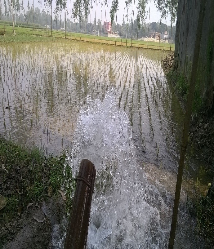
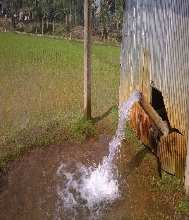
The horrors of arsenic in Bangladesh Some maps have been collected according to the British geological survey (British geological survey, Department of public health Engineering in Bangladesh (DPHE).9 2001 Arsenic contamination of groundwater in Bangladesh. British Geological survey, to identify the affected areas and critical areas. This particular survey was carried out by borehole sampling that includes all kinds of shallow and deep tube wells. But for this research, in lieu of borehole approach, groundwater was collected directly from irrigation well so that irrigational prospects can also be judged. After collecting the maps two districts were chosen as the study area.
First one is Munshiganj district which belongs to the red zone and contains high arsenic level over 200ppb. On the other hand, the district Bogra was chosen that has arsenic range from 1 to 10 ppb. According to the maps shown in Fig. 1, 10 samples from 9 different upazillas from Bogra and 47 samples from two different upazillas were collected from Munshiganj. The highway nearby irrigation wells are primarily chosen. Upon collection of the sample the GPS coordinates were collected using a GPS meter.
According to the maps shown in Fig. 1, 10 samples from 9 different upazillas from Bogra and 47 samples from two different upazillas were collected from Munshiganj. The highway nearby irrigation wells are primarily chosen. Upon collection of the sample the GPS coordinates were collected using a GPS meter. According to the map 10 samples were collected from 9 different upazillas which were selected as study location. The highway nearby irrigation wells are primarily chosen. Two or three upazillas were covered every day. Upon collection the GPS coordinates were collected using a GPS meter. The study locations were selected from the following upazillas:
- Bogra Sadar(North) 2. Sherpur
- Dhunot
- Shajahanpur
- Shibganj
- Bogra Sadar(South)
- Kahalu
- Gabtoli
- Sariakandi.
According to the British Geological Survey map the red zone that contains arsenic level above 50 was selected for study. In the same process as stated above highway nearby irrigation wells were selected covering a large area. 47 groundwater samples were collected during this period and mainly 2 upazillas were studies and they are 1.Sreenagar 2. Sirajdikhan Both side of highway of Munshiganj was covered in wetlands. So the main challenge was to cross the wetlands by various means. Sometimes it was crossed by boat or bridges or steep and loose pathway situated far away from the highway. 4.0 Result Analysis
4.1 Comparison of TOC
The horrors of arsenic in Bangladesh – As TOC is a very important criterion for defining pollution, health hazard and arsenic concentration for an area, the values of TOC were compared against each other and the result was pretty interesting.
This comparison leads to an interesting finding, which is, here TOC content is very high for an arsenic affected area Munshiganj on the other hand TOC content of Bogra is very low even zero for a sample. Previous studies show that TOC content can be a good source of arsenic release and here the assumption is proved. TOC is very high for this affected region and this is widely varied spatially according to standard deviation as 7.06.
4.2 GIS Spatial analysis:
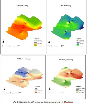
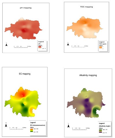
ArcGIS v10.1 is used to map different parameters. For different parameter mapping ‘spatial analysis’ tool was used. The interpolation was done by IDW method with the power was set as ‘3’ and variable distance was set as ’12 points’. Through this maps the patterns of change in parameters can be analyzed. The maps are shown in Fig. 5.
আরো পড়ুন >> বাংলাদেশর সেরা 5টি মোবাইল ব্যাংকিং। Mobile Banking
From the analysis above it is visible that high TOC shows low cluster of pH but high cluster of electric conductivity. It also shows low alkalinity in that region and vice versa. But for Bogra the analysis refers to a TOC and high EC. In this connection it can be added that EC may have relation with TOC concentration of a region.
5.1 Findings of the Study:
- The pH and conductivity range of the irrigation water is within the allowable limit according to WHO guidelines.
- pH range of Munshiganj suggests that it remains in the alkaline range whereas the pH of Bogra remains in the acidic zone.
- The alkalinity, EC and TOC all these are much higher for Munshiganj district comparing with Bogra.
- Munshiganj falls victim to seasonal inundation which can be considered as a good reason for the high TOC value of that region. On the other hand Bogra district lies in high land and irrigation fields seldom gets flooded and shows very low level of TOC.
- Irrigation is not a continuous practice. It has a definite seasonal schedule of operation. Irrigation is generally avoided when the crop is grown and ready to be cut down and it also varies from crop to crop. So it hindered the water collection process.
- In case of rain, owner of the pump kept irrigation closed for two or three days which demanded unwilling reschedule of water collection plan.
- Both Firstly side of the roadway of Munshiganj was covered in wetland. So due to unavailability of crossing mean, many sample locations were avoided during collection.
- Data Secondly were collected from only two different districts for the two cases of arsenic affectedness. Data should be collected from more districts in order to obtain better assessment.
- Only pH, alkalinity, TOC and EC were measured in the present study. More parameters such as –TDS, salinity etc can be included in future study.
- The Finally heavy metals like arsenic, manganese, Iron etc should be measured for future study.
- Regression analysis should be done in the future for establishing relationship between different new parameters.
- These data can be used for future modelling of groundwater.
More samples from different locations of those districts can be collected for better mapping.
 আমি বাংলার কথা বলি


